

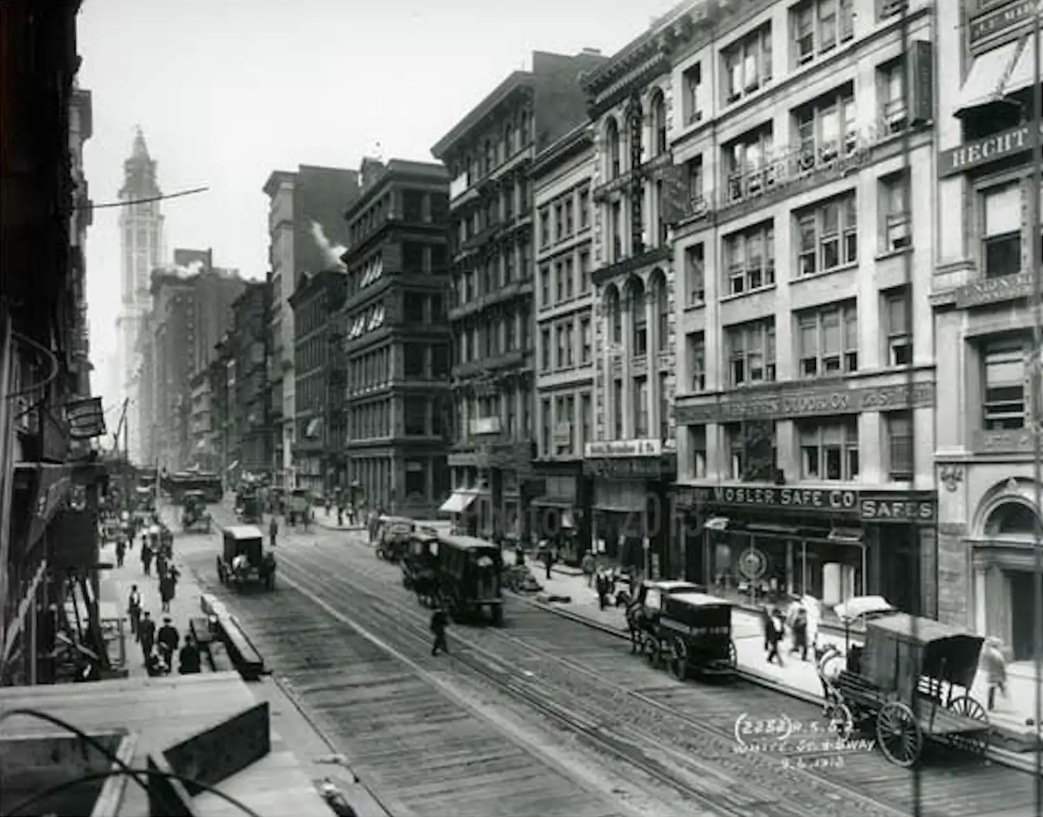
Why Tribeca’s Streets Don’t Make Sense
There are certain things you stop questioning after you have lived in Tribeca long enough.
You know that West Broadway is not Broadway. You know that Hudson Street does not behave quite the way you expect a north-south Manhattan avenue to behave. You know that Staple Street is barely a street at all. And you have probably walked around Duane Park hundreds of times without thinking too hard about why a tiny triangular park is sitting in the middle of what otherwise looks like a street.
After more than twenty years in the neighborhood, I realized recently that I knew how to navigate all of these quirks without actually knowing why they existed.
As it turns out, Tribeca’s streets are not confusing by accident. They are a map of what was here before.
Most of us think of Manhattan as a grid. Numbered streets. Long avenues. Right angles. A system so orderly that once you understand it, you can find your way around huge sections of the city without looking at a map.
Tribeca belongs to an older New York.
The Commissioners’ Plan that created Manhattan’s famous street grid was adopted in 1811 and applied primarily to the largely undeveloped part of the island north of the city that already existed. By then, much of the street network in what we now call Tribeca had already been laid out.
And it had been laid out in pieces.
The Historic Districts Council describes the early Tribeca street pattern as running at right angles from Greenwich Street on one side and diagonally from Broadway on the other. Those competing orientations created blocks of different lengths and some of the irregular spaces we still navigate today.
One of my favorite examples is Duane Park.
The park feels so intentional now that it is difficult to imagine it as anything other than a little green centerpiece for the neighborhood. But its shape is essentially the leftover result of two street systems meeting imperfectly.
When streets were being laid out in the area in the 1790s, Duane Street became unusually wide where it intersected with another grid running at a slightly different angle. The resulting triangle was too small to build on but unnecessarily large to remain part of the roadway.
So in 1797, the city purchased the parcel from Trinity Church for five dollars and set it aside as public land.
More than two centuries later, that awkward piece of geometry is Duane Park.
I love that story because it explains something larger about Tribeca. Some of the neighborhood’s most charming features exist precisely because everything did not line up perfectly.
Even the names around the park carry pieces of early New York with them.
Duane Street was named for James Duane, a Revolutionary-era lawyer and political figure who became the first mayor of New York City after American independence. Reade Street takes its name from Joseph Reade, an important colonial New Yorker and warden of Trinity Church.
If those two names sound particularly familiar together, there is a reason beyond the fact that the streets run parallel to each other. The Duane Reade drugstore chain got its name from its first full-service store, opened on Broadway between Duane and Reade Streets in 1960.
It is one of those very New York details hiding inside something most of us have said a thousand times.
Leonard Street has an even more local origin.
Much of this area was once associated with the Lispenard family, major landowners whose name survives on Lispenard Street. Leonard Street was named for Leonard Lispenard. Historical records show it was laid out around 1797, ceded to the city in 1800, and widened a few years later as the neighborhood developed.
Worth Street has changed identities entirely. It was once called Anthony Street and was renamed in 1854 for General William Jenkins Worth, a military figure from the War of 1812, the Seminole Wars and the Mexican-American War.
Franklin Street has its own complicated history. A section was once called Sugar Loaf Street, a reference to the sugar-refining industry that operated in this part of lower Manhattan. Another section west of it was known as Provost Street. The pieces were eventually joined, and by the early nineteenth century the street had taken the Franklin name.
That patchwork history helps explain another peculiar Tribeca phenomenon: sometimes even the building numbers seem to be working against you.
Tribeca Citizen investigated this exact question several years ago after a reader noticed that Reade Street’s odd and even numbers did not follow the convention she expected.
The explanation from the Manhattan Borough President’s Topographical Bureau was wonderfully simple: downtown Manhattan had public streets and building addresses before the city established later rules intended to make numbering more consistent.
In other words, the system did not begin as a system.
New rules were layered over old streets, existing addresses, former property lines and pieces of roadway that had already been named, numbered and used for decades. In some places, the old logic survived.
There is another layer that is even easier to forget: portions of the street network itself have disappeared.
The Tribeca we walk today is not the complete Tribeca street map of a century ago. Large twentieth-century projects altered sections of the neighborhood, particularly on the western side. Independence Plaza and Borough of Manhattan Community College changed the earlier street pattern, and stretches of streets that once continued through that part of the neighborhood simply no longer do.
That means the strange little fragments, triangles, bends and interruptions we encounter today are not imperfections in a master plan.
There was never one master plan.
Tribeca was assembled over time from estates and farms, early residential streets, commercial corridors, markets, industrial buildings and later redevelopment. Each generation inherited a street network from the one before it and changed parts of it without completely erasing what was already there.
That may be one of the reasons walking here feels so different from walking fifty blocks uptown.
The streets do not pull you relentlessly toward the next numbered intersection. They are open and narrow. Buildings terminate views. Tiny streets appear unexpectedly. A park occupies a leftover triangle. A street name turns out to belong to someone who lived more than two hundred years ago.
You can see the neighborhood’s history without ever entering a building.
You just have to look at the map.
And after all these years of walking these blocks, I think I like Tribeca a little more knowing that some of its best qualities came from the fact that the pieces never fit together perfectly.
Social Cookies
Social Cookies are used to enable you to share pages and content you find interesting throughout the website through third-party social networking or other websites (including, potentially for advertising purposes related to social networking).