I have always loved West Chelsea, in part because it is one of those New York neighborhoods that is so recognizable once you’re inside it, even if its boundaries are a little unclear.
There is not one obvious moment when you leave ‘Chelsea’ and enter ‘West Chelsea.’ Its borders are debatable, and depending on who you ask, they may shift by an avenue or several blocks. But walk west through Chelsea toward the Hudson and the difference becomes increasingly easy to see.
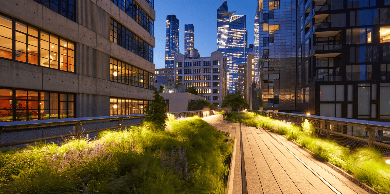
The brownstones and smaller residential buildings give way to former warehouses and larger industrial spaces. Galleries become part of the streetscape. The High Line appears overhead. Tenth and Eleventh Avenues feel broader and more open, and some of New York's most ambitious contemporary residential buildings rise against a backdrop that still reveals the area's industrial past.
So how did one section of Chelsea develop an identity distinct enough that we started treating it as a neighborhood of its own?
The answer begins long before the High Line.
The Divide Was There From the Beginning
Chelsea's name dates back to 1750, when retired British Army officer Thomas Clarke purchased an estate on Manhattan's west side and named it “Chelsea” after the Royal Hospital Chelsea in London, a home for British Army veterans. His grandson, Clement Clarke Moore, later inherited and subdivided portions of the family property for residential development, and beginning in the 1830s, rows of brick and stone houses began appearing on the blocks east of what is now Tenth Avenue.
West of Tenth Avenue, however, Chelsea developed very differently.
The Hudson River shoreline originally sat considerably farther east than it does today. As landfill extended Manhattan westward during the nineteenth century, new land became available along a working waterfront increasingly defined by industry, freight and manufacturing.
That created a distinction that is still surprisingly visible today. Chelsea east of Tenth became largely residential, while the blocks closer to the Hudson filled with warehouses, factories and infrastructure designed around commerce.
So even going back to the 18th century, West Chelsea was already beginning to feel distinctive from Chelsea proper.
Then the Art World Moved West
For much of the twentieth century, the far western blocks of Chelsea were not a destination for most New Yorkers. That began to change when the art world discovered something valuable in the neighborhood's industrial past: space.
Dia Art Foundation established a presence on West 22nd Street in the 1980s. Then, in 1994, Matthew Marks opened a commercial gallery nearby at a time when SoHo was still the center of New York's contemporary gallery scene.
But SoHo was changing. Rents were rising, retail was moving in, and the large, relatively affordable industrial spaces that galleries needed were becoming harder to find.
West Chelsea offered exactly that.
Paula Cooper was among the pioneering galleries to establish a presence in Chelsea, and over the years some of the biggest names in contemporary art followed. In 1999, Gagosian relocated from SoHo to West Chelsea, beginning a wave of similar relocations of galleries from around Manhattan to this emerging art center, including David Zwirner, Hauser & Wirth, and most recently Pace Gallery as recently as 2013. These former warehouses and garages of the West 20s are now the scene of one of the most important contemporary art districts in the world.
I find this part of West Chelsea's history particularly interesting because the industrial buildings became something that the neighborhood could use to reinvent itself. High ceilings, large floor plates and loading spaces designed for manufacturing happened to work remarkably well for contemporary art.
This is very similar to the warehouse-to-gallery conversion stories seen in SoHo and Tribeca, and it’s proof of Manhattan’s ability to always be reinventing itself.
The High Line Changed What Came Next
The same thing eventually happened with West Chelsea's most recognizable piece of industrial infrastructure.
The High Line was built as an elevated freight railroad as part of the West Side Improvement project, carrying trains above the streets and directly into industrial buildings. After the last train ran in 1980, the structure sat unused for years and came close to demolition.
Friends of the High Line began advocating for its preservation in 1999, but saving the railway soon became connected to a much larger conversation about what West Chelsea could become.
In 2005, New York City created the Special West Chelsea District. The plan encouraged residential development, supported the growing arts district, facilitated the reuse of the High Line as public space and established guidelines for new development around it.
One detail from the plan is particularly revealing: the city described West Chelsea as a transition between historic Chelsea to the east and the emerging Hudson Yards area to the north.
That is a remarkably accurate description of how the neighborhood still feels.
When the first section of the High Line opened in 2009, West Chelsea was already being seen as its own distinctive neighborhood, versus as just a micropocket of Chelsea.
Architecture Became Part of the Identity
The rezoning and the High Line created unusual opportunities for residential development in an established downtown neighborhood, and some of the world's best-known architects began designing here.
Jean Nouvel's 100 Eleventh Avenue brought a dramatic glass façade to West 19th Street. Zaha Hadid's 520 West 28th Street introduced a sculptural steel-and-glass building directly alongside the High Line. At Lantern House on West 18th Street, Heatherwick Studio used brick and projecting bay windows to reinterpret the industrial architecture surrounding it. More recently, One High Line, designed by Bjarke Ingels Group, added two twisting towers between Tenth and Eleventh Avenues.
These buildings are designed to be contextual with the gallery spaces nearby, almost an extension of the art inside them, which is proof positive of West Chelsea’s close association with modern art and architecture.
There is the High Line, the Hudson River, the old industrial buildings and the world-renowned gallery district, all occupying the same relatively small area, now joined by contemporary residential architecture.
For someone who works in real estate, that evolution is fascinating to watch. There are few places in New York where the relationship between a neighborhood's past and its newest residential architecture is this visible.
Life West of Tenth Avenue
For visitors and residents alike, The High Line is really the artery of the neighborhood.
Running through West Chelsea, The High Line, along with the Hudson River Park, creates another expansive public space along its western edge. In between are the galleries of West 19th through West 27th Streets, Chelsea Piers, Chelsea Waterside Park and a growing collection of restaurants and businesses.
You can see an exhibition at David Zwirner or Pace, walk the High Line, enjoy an afternoon at Chelsea Waterside Park and end the day watching the sunset from the Hudson. Chelsea Piers, which opened in 1995, turned another piece of the working waterfront into a place for sports and recreation.
All of that contributes to West Chelsea’s distinctive identity.
While traditional Chelsea feels more intimate, with its brownstones, tree-lined residential streets, restaurants and longtime institutions, West Chelsea has a different scale, with wider avenues, larger buildings, and modern art and architecture woven into daily life. The Hudson nearby gives the neighborhood a sense of openness that is difficult to find elsewhere in downtown Manhattan.
Where Does West Chelsea Actually Begin?
How do I define West Chelsea’s borders for buyers? In this case, I have to approximate.
The Special West Chelsea District gives us one official planning boundary, but neighborhood identities rarely follow zoning maps perfectly. Tenth Avenue is probably the clearest dividing line historically, although depending on whom you ask, West Chelsea can creep farther east or blur into the Meatpacking District to the south and Hudson Yards to the north.
What can make an emerging New York neighborhood like this distinctive isn't necessarily an official boundary, but rather what you feel, see, and experience when you’re there. It’s the accumulation of history, architecture, businesses, and public spaces that make people stop and realize, “Oh, so this is West Chelsea.”.
That’s how I characterize the neighborhood for buyers when they’re considering it, which all becomes apparent to them when they explore the area for themselves.
You can still call all of it Chelsea, and technically you wouldn't be wrong.
But walk west toward Tenth Avenue and continue toward the Hudson. Somewhere along the way, the city begins to feel different.